Feeds:
Posts
Comments

Archive for the ‘Yorkshire Wolds Way’ Category


YWW Day 8

Staxton to Filey Brigg (12 miles)

It was an early start this morning as we had a train to catch from Filey.  With an hourly service from the station it meant that if we missed it, it would have a knock on effect for our connections to get back to Glasgow.

Ready for an early start

Ready for an early start

I had woken at around half past four, even before the alarm had gone off.  Rather than lie there, I found out if my father was awake (he was) and suggested that we get on with it.  A petrol station across the road had provided us with breakfast/lunch so there was no need to break open the stove, meaning we pitched the tent and packed up in what was an eerie, still silence.  It was pitch black, or would have been if not for the street lights on the road.

Early morning light over Flixton Wold

Early morning light over Flixton Wold

It wasn’t long before we were on our way, the walking poles clacking loudly on the tarmac just as the first light began to creep in from the East.   We were heading for Wold Lane which would take us back up to Staxton Wold, a stiff climb to start the day.  It was slow work, not helped that half way up the hill where a track crossed our way we missed the path and spent 10 minutes wandering about an old quarry.  It’s amazing how easily one can miss the correct path in the dark.

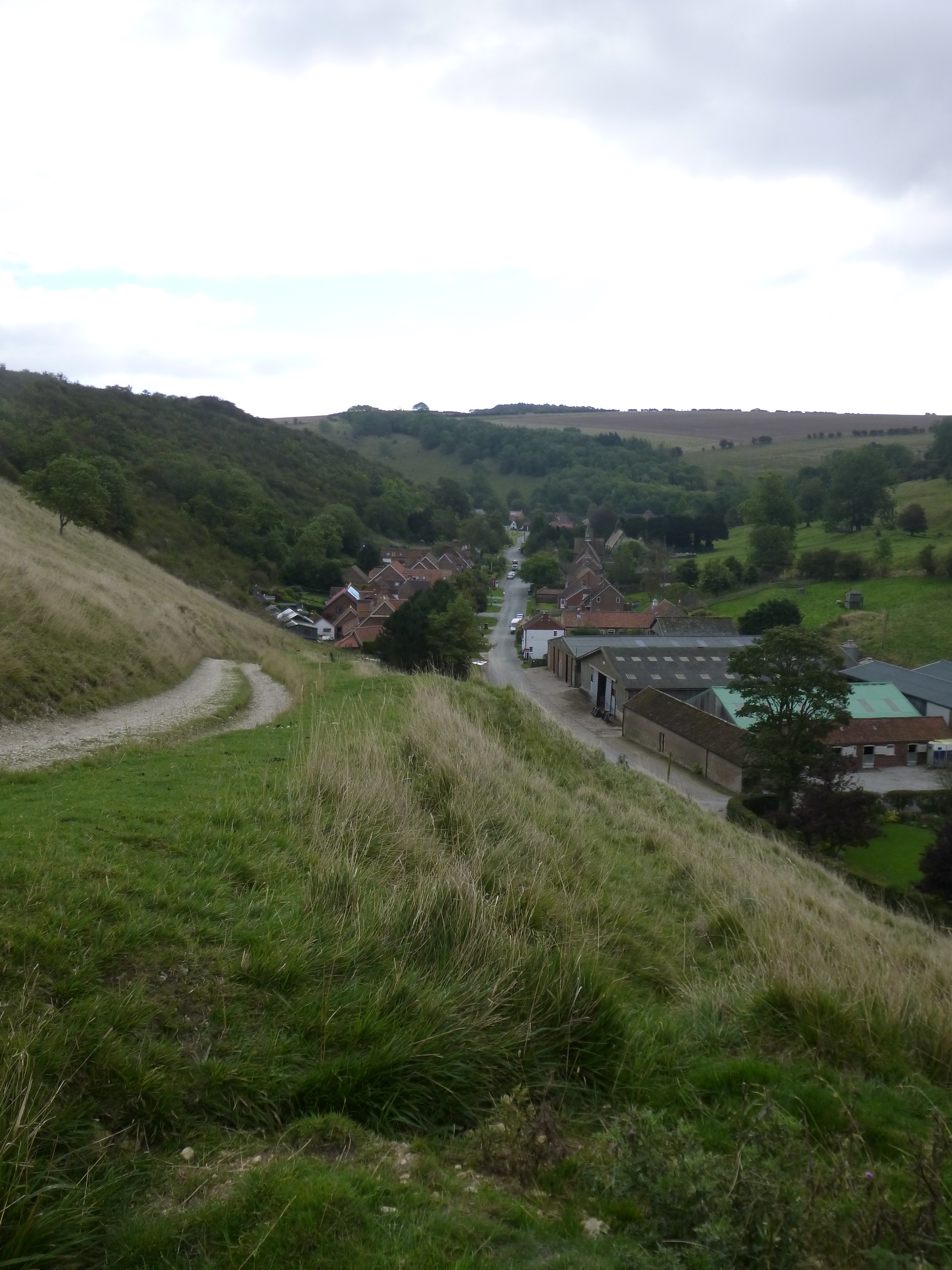
Eventually we emerged into the fields at the top of the Wold and passed the RAF base, feeling a little bit naughty with all the CCTV cameras around.  The place was well lit up giving a strange luminescence to the surrounding land.

Crossing Flixton Wold

Crossing Flixton Wold

The base was quickly left behind as the path started to descend into a sunken lane, plunging us into near darkness.  Thank god for head torches!  As the path dropped we slowed our pace, keeping a lookout for the left turn that was coming up.  We needn’t have worried as the fingerpost loomed out of the dark showing us where to go.  The path here was a steep climb in between hedgerows with a soft, almost sandy/chalky surface.  It was also pitch black in there, such was the denseness of the vegetation, almost like entering a tunnel.

Part of the Flixton Wold roller coaster ride

Part of the Flixton Wold roller coaster ride

At the top, the Wold opened out before us, grey and muted in the limp light.  It was a bit of a roller coaster here, the path following every lump and bump towards Flixton Wold as the light increased to full, if somewhat greyish and overcast, daylight.  To add to the atmosphere, early morning mist had gathered at the bottom of some of the dales, especially Lang Dale, adding to the eeriness of the morning.

Mist in Lang Dale

Mist in Lang Dale

On reaching a quiet road, we stopped for a while to have breakfast – it was still only around 7 a.m. – as I’d not really been hungry when we set off.  The next stage was a drab little walk along the road to Camp Dale, the last of the Wolds we would encounter on the trail.  The track crossed the dale then climbed up onto the bank on the other side giving fine views down its length.  Here there was a final Wolds Way bench and acorn telling us that there was only 7 miles to go.  We should be finished by lunchtime then!

Camp Dale - only 7 miles to go.

Camp Dale – only 7 miles to go.

The path here dropped into the dale and turned into Stocking Dale (saying goodbye to the Centenary Way which had been sharing a route with us for a long time), this place being another site of a deserted medieval village, although there really is nothing to be seen on the ground.  Stocking Dale, unlike many of the other dales we had walked through, was quite heavily wooded, lots of scrub trees amongst the more mature ones.  It was also rising steadily, the dale petering out on a farm track, the only evidence of its existence just a small dip in the ground.

P1030981

There was a real feeling that this was the final stretch to Filey and as we crossed a road at Stockendale Farm the sun threatened to appear for a while.  To the north there were fine views towards the North York Moors, with the lower ground in-between covered in low lying mist.

The small village of Muston heralded the outskirts of Filey, we stopped on a bench for a while to rest before walking through the village.  It was still stupidly early, so unsurprisingly the pub wasn’t open for business.  The path passed up what looked like a garden path alongside some pretty houses before we had to take our lives in our hands crossing the A165, busy with rush hour traffic.  From there it was downhill, skirting hedges and the local secondary school, before we were walking through the streets of Filey itself.

Close to Muston

Close to Muston

Once in the centre, it was straight to the Tourist Information Centre with an ulterior motive.  I collect cloth badges from these walks, and was happy to find that the Wolds Way had its own, which was duly bought.  There was also the small matter of ditching the backpacks, which the staff there kindly allowed us to do (though it was, apparently, strictly against their rules) meaning we could walk unencumbered up to Filey Brigg.

Filey

Filey

The route here wasn’t well signed, but you couldn’t really go wrong – turn left at the beach and walk to the long sticky out bit. There was one last kick in the backside, a steep climb up steps to get back up to the correct hight for the finish, leaving us with a gentle stroll to the monument that marks the end (or start) of both the Wolds Way and the Cleveland Way.

Turning towards the Brigg

Turning towards the Brigg

It was so tempting just to keep walking!

Still, there was a train to catch, so we retraced our steps, this time taking a route along the beach, to the TIC, picked up the sacks and made our way towards the station with plenty of time to spare.  This meant there was the chance to stop for some celebratory fish and chips before the short shuffle (I had certainly stiffened up) to the station, just as the rain started.

The finish

The finish

Day Rating 7/10

Not the most exciting of days, but had some pleasant and interesting sections on it.  The path over Flixton Wold was surprisingly hard work and Camp Dale made a fine finale to the Wolds experience.  The finish at Filey Brigg was a bonus, and although we didn’t go all the way onto the Brigg it certainly added to the finish.  A nice symmetry with the start on the Humber.

Overall Rating 67/80 (83%)

Now to walk back!

Now to walk back!

A fine trail that rates in the middle for me – not one of the best, there were no what I would call “outstanding” days.  That isn’t to say that the trail is bad – far from it (it possibly didn’t help that we were walking in late summer/early autumn, when most of the wild flowers and summer vegetation were over).  What I would say is that this is a hugely enjoyable trail with some great scenery, history, lovely little villages that nestle in the Wolds and some cracking surprises – it is also not as easy as it looks – while most of the walking is gentle there are quite a few ups and downs for the unsuspecting walkers.  This also has to be one of the quietest trails I’ve walked, with very few users on it – only the occasional dog walkers near villages.  This isn’t that surprising as the route is actually quite remote – there are very places that are passed through between stops.  One real bonus (that many other paths are lacking) are the number of benches on the route.  The carved trail benches are a work of art in themselves, and every single one of them has been placed thoughtfully at a great location.  Not only that they always seem to appear at just the right moment.

Well worth doing, and to risk a cliché, a very good trail for an introduction to trail walking and those who are looking to cut their teeth on a long distance path.


Read Full Post »


YWW Day 7

On the trail again

On the trail again

Wolds Way Campsite to Staxton (12 miles)

Peeking out the tent after waking up I found the morning was cloudy.  The sort of grey black stuff that looked a little threatening, rain a real possibility.  Still, it was dry so we swiftly packed the tent up and started an ad hoc breakfast of beans, bacon and cheese, plus a little porridge on the benches outside the utility block.  As we tucked into our al fresco grub we were presented with the sight of a very large range rover depositing its very large driver into the toilet block.  He must have driven no more than around 100m from his caravan to the toilet block.  Words fail me.

Pesky Wabbits

Pesky Wabbits

The walk to Staxton would be different from the previous days, more along the line of a ridge with views out towards the North York Moors.  Leaving the campsite we dropped down the hill to rejoin the main route, passing along the edge of a large mixed plantation, again with a plethora of “private” and “keep out” signs.  There was even one warning dog owners of Fox snares located in the wood.  All in all it was a very pleasant  woodland walk to start the day, and the temperature was perfect.

The offending path.  This was full of Lupine booby traps

The offending path. This was full of bunny booby traps

At the edge of the wood the views suddenly opened out north and we were walking through fields again.  A rather novel warning sign appeared.  “Rabbits at Work”.  It was needed – without it I would imagine there would be a queue of people at A&E with various broken bones in their feet and legs.  The critters seemed to be engaging in some sort of civil engineering project judging by the size of some of the (well hidden) potholes adorning the path!

The view North

The view North

The only downside was the lingering cloud.  On a better day we would have been able to see the sea!  This was a great ridge walk which meandered its way along field edges, hedgerows and woodland, all the while the world spread out on our left shoulders.  Another Wolds Way bench appeared and we spent a little time conjecturing on the unusual layout of the church and spire in East Heslerton.

An unusual church

An unusual church

A large pig farm was passed, hidden in the trees, the noise and smell incredible.  I’m fairly sure I can still smell it now!

P1030946

This was open country with big views, arguably one of the best sections of the trail.  Suddenly we were back on road again, dropping steeply towards Sherburn, and here for once is a nice bonus, the path having been routed through an adjacent field to avoid the road.  Much nicer.  It was still a bit early to stop, so we stayed with the trail (which bypasses the village) cutting along a sandy farm track before a short road walk led to a steep, but mercifully brief climb.  This section was a bit of a roller coaster, up and down the hill on a bridleway and through woodland complete with shooting butts.

Panorama

Panorama

The guidebook mentioned another tea room at Potter Brompton, and once again we diverted off on the assumption it would be open.  Fortunately this one was, and although a little expensive, the fare was superb.  We even managed to eat outside in their pretty gardens as the sun began to make an appearance.

Another bench looking weathered

Another bench looking weathered

As we walked back up the lane to the trail an old chap caught us up, he had seen us pass on the way down.  He joined us for the walk and we chatted all the way up to Staxton Wold where he left us to walk back.  It seems he loves walking in the area, but there are so few people that he can walk with he takes to ambushing walkers and tags along with them for a while.  He could fair shift for his age though (he was carrying a bit less than us).

P1030932

From there we walked up to the RAF base, a station that was one of the places where radar was pioneered in the early stages of the second world war.  We left the trail here, turning left to walk down a green lane to the village of Staxton itself, a steep drop that we would have to revisit in the morning.  Our campsite for the night was a big field (campsite apparently) next to a pretty little camping and caravanning club site, part of a larger complex which included a carvery pub and an antiques centre.

Acorn

Acorn

To be honest the carvery was average at best and the beer not particularly great (their Theakstons was ok), but it was food and drink and hot, which is all that really matters.  The facilities on the campsite were pretty decent, but the big problem was the noise from the busy A64 which didn’t let up until well after midnight.  In retrospect we could have pushed on and wild camped somewhere better, but that’s never really a good idea near a military installation!

P1030939

Day Rating 9/10

The tearoom

The tearoom

The Wolds Way campsite was great (if a little breezy) and at least had a small shop meaning we could cobble together stuff for an evening meal and breakfast.  A really enjoyable and varied walk with constantly changing wide open views.  A great lunch stop as well not too far off route.  Just a pity about the campsite – ok for one night – I wouldn’t want to holiday there!

Our impromptu walking companion (on the right)

Our impromptu walking companion (on the right)


Read Full Post »


YWW Day 6

North Grimston to Wolds Way Campsite (7.5 miles)

It was quite simply a stunning morning.  Clear blue skies and not too warm. Again, with a relatively short distance to go there was no great rush to be off, so we sorted breakfast and gave the tent some time to dry off the dew that had formed overnight.  While we were waiting the father-in-law of the farmer, a Hungarian, had been working round the farm, finally coming into the orchard and picking fruit from the trees.  As well as apple there was plum, and he offered us some fresh from the trees.  The plums were amazing, ripe and sweet.  He spoke little english, but we did have a conversation of sorts.  Hungary he said, is “very beautiful”, but is being ruined. “Politicians – idiots!” I guess some things are exactly the same the world over.

Back on the path (campsite in background)

Back on the path (campsite in background)

While we had been talking and sampling the produce, amusingly, cattle in the next field were getting impatient for their breakfast and had begun to show their displeasure by rattling their gate and complaining loudly about the service. It wasn’t far to drop down a steep track from the farm and then up a lane to which would turn into the Wolds Way.  This lane climbed steadily and on the odd occasion we paused for breath the views back to the campsite and the Vale of Pickering were superb.  As the land was rising, the lane started to contour and it passed through a pretty farm – Wood House.  Eventually we reached the top of the climb, opening out into more arable land and a lovely patch of wild flowers growing in amongst some wild rape.

Looking back from Wood House Farm

Looking back from Wood House Farm

Suddenly the path was weaving in and out of woodland on the long climb through Settrington Wood eventually reaching a set of rather industrial looking farm buildings near Settrington Beacon.  Next was a large woodland plantation of mixed conifer and broadleaf trees with plenty of evidence of recent thinning work.  The woodland was quite lovely and very peaceful, but once again there was a plethora of signs warning walkers not to stray from the path onto private property.  We had also started to go downhill again.

Plodding

Plodding

Emerging from the wood we found ourselves on top of the scarp looking north over Wintringham, the North York Moors rising in the distance.  The scene below was also a hive of activity, a large number of beaters with flags making their way across the farmland below.  There was another shoot in progress. There was a bench here and we lingered a while, watching the beaters make their methodical way across the front of us.  Suddenly birds started flapping overhead from the woodland behind us, followed soon after by the rather undignified noise of someone clattering through undergrowth.  Another beater emerging from the woodland.  He stopped to check that we weren’t heading in the direction of the guns, and we set off along a chalky lane towards Wintringham.  Here we passed over a very unusual sight on the Wolds Way (if you don’t include the Humber) – running water.  Wintringham Beck must have been the first (visible) watercourse we had passed over on the trail.

Leaving the woods

Leaving the woods

The guide book mentioned that there was a tearoom close to Wintringham, a place called “Wolds Way Lavander”.  It would surely be open on a Saturday in September.  To get to it was a diversion of about 1km.  It wasn’t.  Open.  Bugger.  (While the guidebook does say check opening, they do advertise the tea room from a  Waymarker in Wintringham.  It would be nice if they put the opening times there as well!). There was a lot of muttering going on as we made our way back to the path which skirted round the village before stopping for a rest at St Peter’s church, usually locked, but open for visitors for the day.  This medieval church is no longer used by a regular congregation, but is preserved by the Churches Conservation Trust and has a fascinating interior, including some stunning wood carvings.

In the church

In the church

There was another of the carved acorns where the path leaves the village before entering Deep Dale plantation.  The walk through the woodland was very pleasant, once again, until we met a finger post which was set at a rather jaunty angle.  On closer inspection it turned out to be intentional, the inscription “steep gradient” giving us the final clue as to why.  Fortunately the steep gradient was relatively short but it still left me gasping for breath at the top.  The good news was that we were close to our campsite for the night and as we left the woodland there were quite a few people here out for an afternoon stroll.  There was a rather attractive art installation here too, along with a recreation of a dew pond, buzzing with all sorts of insect life.

Understatement!

Understatement!

15 minutes later we were pitching the tent in the campsite, a wonderful location high on the Wolds.

Day Rating 9/10

Another fine and varied day.  Good views mixed in with some woodland walking and the interesting church at St Peters was a bonus.  The campsite had limited supplies in it’s meagre shop, though, so we had to be a little bit creative about our evening meal! P1030908

Read Full Post »


YWW Day 5

Thixendale to North Grimston (7 miles)

There was no rush to be away today, as we only had a short hop to a farm campsite just above North Grimston.  Breakfast was waiting for us in the bar and it is quite possibly the finest full English Breakfast I have ever experienced.  What a great set up for the day.

Thixendale

Thixendale

Not being in any hurry we sat and nattered with the Landlord Steve who was a font of knowledge about the village and the area.

It was 10 o’clock by the time we were on our way, with a forecast of clearing skies for the afternoon.  The route took us through the village, snuggled down at the bottom of a Dale.  It’s a lovely place with bags of character, including the village hall.  It had once been leased as a Youth Hostel (YHA), opening only for the season during the summer.  It closed in 1999 after the YHA wanted to upgrade it, the village council understandably wanted to increase the rent after the upgrade which the YHA then refused to accept.  They also wouldn’t continue running the hostel without the upgrade, resulting in its closure.  It’s a sad story which has been mirrored by many small and valuable hostels around the country which are sadly no longer with us.

Leaving Thixen Dale behind

Leaving Thixen Dale behind

The village was soon left behind, climbing steeply up the side of the dale along a chalk farm track.  Below the village sat nestled sleepily in the valley.  A quite wonderful setting in the heart of the Wolds.  At the top of the hill we could see up two spectacular dry valleys, one Thixen Dale, the other Water Dale.  There were even a couple of walkers meandering slowly up it – it was nice to see some other walkers, even at a distance!  The Wolds Way here was something of a footpath super highway, with no less than four paths sharing the same route at varying points – the Centenary Way, the Chalkland Way and the Wolds walk as well as the Wolds Way, all interesting looking paths.

P1030832

It was a short hop over Cow Wold into Vessey Pasture Dale which was a hive of activity.  At first it looked like walkers, spread out coming the opposite way, but it soon became clear that they weren’t walkers at all as they were hanging about in fields well away from the path.  All became clear when they eventually started off in the same direction waving flags that we had mistaken for backpacks (at distance).  The loud “thwacks” that was made by the fast moving flags in the air soon came thick and fast and as we descended the steep wold the first volleys of gunfire came from somewhere to our right.


Vessey Pasture Dale

Vessey Pasture Dale

There was no walk along the dale here, instead the path heading straight up the other side, quite steeply.  Leaving the pheasant shoot behind we emerged at the very top of Deep Dale, here no more than a small dimple in the ground.  It was a pleasant, if unspectacular walk along the top of the dale, and as it deepened we stayed to the top, following it all the way to the site of a deserted medieval village, Wharram Percy.  Originally the Wolds Way bypassed this completely taking a more direct route away from the dale.  Thankfully what had been an optional diversion is now the official route which runs straight through the site.


First glimpse of Wharram Percy

First glimpse of Wharram Percy

The village is in a lovely setting and all that remains are the ruins of the church, a millpond, and a renovated farmstead which housed the archeologists during the extensive digs that had been ongoing for over half a century.

There were quite a few visitors to the site, despite the relatively remote location. The lumps and bumps of the village supplemented by interpretation boards.  Surprisingly it wasn’t plague that did for the village, but the landowner.  They evicted the residents, seemingly wanting to use the land to graze livestock.  The site was very peaceful and we lingered a while enjoying the sun. At the request of a concerned little old lady I even managed to rescue a Partridge that had become stuck in the wire mesh that surrounded the trunk of an old Yew.  My good deed for the day, unless of course, it found its way onto the gun line from earlier…

Wharram Percy pond

Wharram Percy pond

Eventually we left the site, crossing the old trackbed of the former Yorkshire Wolds Railway and climbing steeply up the path to the car park, a considerable walk of almost 1km for visitors to the site!  Here there were some super views to the north and when we turned onto the quiet country road we had the Vale of York spread out before us once more.

Ruind Church

Ruind Church

This was now a steady plod in fine weather to Wharram le Street, a very small village with not much more than a church and telephone box.  The last stretch is up a stony track and I finally manage to get a photograph of one of the many butterflies which have been flitting about as it sunned itself on the path.

Our campsite was a little off route on a farm near North Grimston and involved a walk down the verge of a busy B road.  In retrospect we should have stayed on the path which would have taken us to a track which led to the farm.

P1030857

The site itself is a Caravanning & Camping club CL, although they allow backpackers in to camp as well.  The caravan section was a stunning location, sitting on the edge of a ridge with wide open views.  I must admit to being a little disappointed that we weren’t allowed to pitch there.  Instead we were led to the farms orchard, which was in a far more sheltered spot.  There were apple and plum trees here, all thick with fruit, and in itself was a delightful little spot.  A nice addition was the rustic “thunder box” which adorned the centre of the orchard, complete with transparent plastic roof (great for star gazing while on the job – so to speak).

Panorama from the campsite

Panorama from the campsite

The place was also full of free range hens, one of which was just sitting in a rather peculiar position with her wings outstretched.  On closer inspection she had a cluster of chicks huddled under her wings

Day Rating 9/10

Once again another fine day with some super scenery good weather and some interesting history.  Short and sweet.

Thunderbox is go

Thunderbox is go


Read Full Post »


YWW Day 4

Millington to Thixendale (12.5 miles)

The new path up Sylvan Dale

The new path up Sylvan Dale

The stay in Millington had been superb.  Great accommodation, great pub and great breakfast!

It had been nice and toasty in the Village Hall overnight meaning a very comfortable nights sleep.  The only downside was the rather comical attempts at getting off the camp bed without depositing myself on the floor.

I lost.

From near the top of Sylvan Dale

From near the top of Sylvan Dale

With breakfast done and dusted, we popped the key to the hall back through the door and made our way to the short but steep climb out of the village back to the Wolds Way.  An alternative permissive path had been mentioned to us the previous day and we took this, contouring round the lower slope to pick up the trail just above the impressive Sylvan Dale, admiring the stunning views over Millington on the way.

Approaching Nettle Dale

Approaching Nettle Dale

Our last visit here had been in deep snow coming from the opposite direction, and resulted in an impromptu sledge down the hill on our backsides.  Since then, the steep path has been replaced with a more gentle option that contours gently up the slope.  Much easier and much more sensible.  It obviously hadn’t been open that long as the track was still fairly unworn, but it was a very welcome change to the route.

Pasture Dale

Pasture Dale

Once on top, there were fine views and easy walking to where the Minster Way diverges in Nettle Dale.  We were truly in Wolds country now and the scenery here was nothing short of fantastic.  At the foot of the dale a herd of cattle with calves were grazing.  Lying right on the path was a huge bull.  He didn’t move and we were hardly worth a glance as we passed gingerly through the herd, climbing steeply up the other side.  As we approached the head of the dale a Red Kite was partaking in some acrobatics, trying to shake off the attentions of an annoying Crow.

Another carved acorn

Another carved acorn

Jessop’s Plantation was a brief and pleasant distraction just before we burst out at the top of Pasture Dale, the third such spectacular Dale in as many kilometres.  The path stayed high to the head of the Dale and led us up a short incline to another of the carved acorns.  On a fine day the view would be second to none, but for us, with the grey overcast sky it was a little more limited and muted.

The next section was a little bland, following a farm access track bypassing Huggate.  We had originally planned to stop here but plumped on Millington instead.

P1030775

There was another steady climb up a farm track, this time a lovely avenue of Cherry trees with nice wide grass verges to walk on.  The way turned up a hedgerow and we were soon in for a big surprise.  A kissing gate led to the huge Horse Dale, one of the deepest and most impressive of the dry valleys.  A national trail bench had been placed here in the perfect position and it would have been rude not to spend a while lingering and enjoying the view.

Horse Dale

Horse Dale

The trail dropped gently down to the bottom of the dale, heading up the bottom of the smaller, but no less impressive Holm Dale.  It was strange and quite eerie walking along the bottom of the dale.  It was also a little steeper than it looked, the kilometre or so turning into quite hard work.  There was also the remains of quite a few pheasant littering the path – something was living off them!

Holm Dale

Holm Dale

As we approached Fridaythorpe we passed a house with a blue plaque declaring that “Lance Moxton the first person in the wolds to start collecting vintage washing machines” was a resident.  It looked a nice enough village with a pleasant pond, a lovely bus shelter (part of the Wander – Art on the Yorkshire Wolds Way scheme) and a sign marking the halfway(ish) point of the trail.  In reality it was a bit of a ghost town, every second house seemingly up for sale and the pub empty and run down looking.  The only place that seemed to be doing well was the Seaways Cafe – an archetypal road cafe that seemed to be very popular with bikers as well as being stuck firmly in the 1960’s.  It did a fine baked potato.

Inside St Mary's

Inside St Mary’s

On the way back through the village we stopped to visit the unusual, squat and very ancient looking St Mary’s church.  It dates from the 12th Century, has a Norman Chancel and probably hasn’t changed much over the centuries.

There is a large mill in the village which the path passes, and we then drop into another dry valley, this time Brubber Dale and West Dale.  Most of these dales are so well hidden, that it would seem possible for people who have lived in the area all their lives and never walked anywhere, to be completely oblivious of their existence!

West Dale

West Dale

It’s not long before we are overlooking Thixendale itself, and spend a little time admiring the sculpture “Time and Flow” from a bench high above.  The dale itself is lovely and the track along the bottom must be reminiscent of what roads were like during the mediaeval period to the tail end of the 19th Century.

Above Thixendale

Above Thixendale

A herd of curious young bulls mooched over to see what we were up to but soon lost interest, leaving us to pass through the lower dale on to a road.  The downside was the 800m or so walk along the road to finish the day off, our destination the Cross Keys pub in Thixendale.

Day Rating 9/10

Not an easy day with a number of ups and downs.  A nice contrast with some spectacular Dales and pleasant walking through arable land.

In Thixendale

In Thixendale

A very special mention should go to the Cross Keys Pub in Thixendale.  The landlord Steve was fantastic. sorting us out in the boot room, then heading off to get us a couple of pints from the bar before we’d hardly dropped the backpacks.  He is so well geared up for walkers having converted an outbuilding for B&B.  Good pub grub and one of the best breakfasts I think I’ve ever had.

Super walkers accommodation.


The Cross Keys

The Cross Keys


Read Full Post »


YWW Day 3

Goodmanham to Millington (10 miles)

Despite the overnight rain we had had a comfortable night, although the rain was still pattering steadily when we awoke.  This meant spending some time pottering about in the tent waiting for the rain to subside, eventually having to take it down wet.  It was a short walk down to the games room/kitchen to sort ourselves out with a DIY breakfast, everything set in place in their fridge.  Breakfast was a leisurely affair as the distance for the day wasn’t very far, as we hoped that the rain would eventually clear.  It did and we were finally on our way by 1030.

The church in Brantingham

The church in Goodmanham

It was a gentle start out of the village, passing the old railway (one of two which served Market Weighton – both now long gone) out into open fields.  The busy A614 crossing, close to a picnic lay-by (complete with greasy spoon cafe), was a difficult one which took a while due to the sheer volume of traffic.  A bit of a dodgy it was too!

Approaching Londesborough

Approaching Londesborough

Here the views started to open up to the west and a passing farmer stopped his tractor for a chat.  His enthusiasm and love of the area was quite fantastic.  Soon we turned into some lovely old estate land belonging to Londesborough Park, a couple of Red Kites flying overhead, and eventually entered the associated village – apparently all the properties there are still rented to the occupants by the estate.

Another acorn

Another acorn

The village church dated from Norman times and as it was open to the public we spent a while looking inside.  A very knowledgeable lady gave us a short history of the church as well.  I could help but be amused by the Burlington family name (the original estate owners), wondering if there was a “Bertie” involved somewhere and if he had ever lived in “Bow”.

Looking over the estate

Looking over the estate

A long road walk ensued after leaving the village, normally a source of irritation, but this was tempered somewhat by the fine views out over the Vale of York with both Drax Power station and York Minster visible in the distance.

Inside the Londesborough church

Inside the Londesborough church

After leaving the road the path gained height, continuing with the fine views and as we approached the village of Nunburnholme (I really hope that the name isn’t literal – there was a Benedictine Priory here), we passed a spectacular Hawthorn hedge, resplendent with bright red berries.  It has been a fine year for Hawthorn, and this must have been an incredible sight when they were out in flower earlier in the summer.

The view west

The view west

There wasn’t much in the village, apart from the church, where we sat for a while on a bench enjoying the sun.  It was a stiff climb out of the village into lovely pastureland, again very reminiscent of the North Downs Way, and once again the views were superb.  We passed through a derelict farm, with what looked like old battery units stand empty, many with their roofs fallen in.  The trail could quite easily have taken the direct route amongst them, but instead was forced to take a winding route down, then back up the hill to avoid it, amongst a plethora of “keep out”, “no trespassing” and “no right of way” signs.

Hawthon berries on display

Hawthorn berries on display

A large mansion appeared below us, apparently now a Buddhist Retreat Centre with a cafe that is open to the public.  I have to admit to being curious, but as we were nearing Millington there really wasn’t a great deal to be gained by a diversion that would add nearly a mile and a half to the day.  We crossed the heavily wooded Warren Dale then began the last climb of the day, a long steady along the top of it on a chalk track.  At the head of the Dale the Way turned a sharp left and after a short distance, as if out of nowhere we were stood above Millington and the best view of the trail so far.

Looking over Nunburnholme

Looking over Nunburnholme

There was another of the National Trail Benches here and we stayed a while just enjoying the view, trying to work out exactly which building was likely to be our accommodation for the night.  We had booked into the village hall, which doubles as a bunkhouse.

Close to Warren Dale

Close to Warren Dale

From there it was a short walk along the scarp to where we linked up with the Minster Way and dropped down into the village where we were met by one of the custodians of the hall. He let us in, settling us in nicely.

Closing in on Millington

Closing in on Millington

Day Rating 9/10

P1030724 The best day so far, and a nice varied walk with some big views.  Lovely section through Lonesborough Park and some fascinating old churches on the way.  Nice to see some Red Kites in the area too.  The finish at Millington was superb, just a great place to end a walk for the day.

overlooking millington

overlooking millington

The village hall as a bunkhouse is a fantastic idea.  It’s not the biggest hall, and if there were more than ten staying there it would be a squeeze.  They have camp beds to sleep on and a fully equipped kitchen.  They even provide a DIY breakfast.  No showers though, but they are looking at funding to get some put in, which would make it perfect.  It was comfortable, warm and a brilliant place to stop for the night.  Not to mention that it is just a 2 minute walk to the pub!  Wouldn’t it be great if more village halls did this?

The village hall

The village hall

Read Full Post »


YWW Day 2

Brantingham to Goodmanham (13 miles)

All Saints Church

All Saints Church

After a comfortable night in the B&B we got a reasonable start, getting breakfast half an hour earlier than intended.  As we were up and about the owners offered to get us away slightly earlier.  We had managed to wash our boots the previous day as well, getting most of the dried crust of the Humber mud off them.

The top of Woo Dale

The top of Woo Dale

It was cloudy and cool as we set off, perfect walking weather, only pausing for a few moments to take some photos of the attractive Brantingham Parish Church.  It was a short road walk before the path turned off, rising steeply up a narrow fenced track to the wonderfully named Woo Dale (I wonder if that has historical connotations?  It would also be a good name for a beer!).  The fenced track seemed to be another “feature” of the Way, obviously designed to keep “undesirables” (aka walkers/hikers) out of the  managed woodland that exists solely to provide game birds to slake the blood lust of the country sportsman.

Stunning dosplay of Hawthorn berries

Stunning dosplay of Hawthorn berries

However, when we reached the top of the hill, the woodland ended abruptly and we were furnished with a fine view over the Humber.  There followed a short drop then a very steep (but short) climb which eventually took us out on to the open down and fine views over South Cave.  The Hawthorn was spectacular, the red berries looking very much like blossom in their abundance.

We dropped down into the village to stock up on some lunch supplies, first passing through an impressive field (wood?) of Willow Coppice, growing very much like bamboo out of the ground.  I’ve only ever seen much more mature coppice and this was obviously harvested regularly.  All became clear as we neared the village, passing a gate advertising Willow Weaving services.

The trail benches

The trail benches

South Cave is a lovely little village (the pubs looked very inviting), and would be a very nice stop over.  We didn’t stay long though and we were soon back on the path along with the odd morning dog walker.  It was a steady but gentle climb and just at the right point we came across the first of the sculpted benches that have been created for the path.  They are unusual, rather rustic and very attractive additions to the Yorkshire Wolds Way.

As we approached Comber Dale, just beginning to drop down to cross an old railway, a loud droning became apparent above us.  We turned, looked up, and what should appear but an old Lancaster Bomber flying low over head.  We just stopped and stared for a while as it lumbered its way north, seemingly taking forever to disappear over the horizon.

A low fliying Lanc

A low fliying Lanc

One of only two that are still flying the chances of it passing right over our heads at that moment must have been remote.   Still, it was a nice little bonus to the days walk.  The noise of the engines was just incredible from one – how impressive it must have been to hear and see these taking off and mustering as squadrons during the war.

We crossed the dismantled railway into a quite lovely woodland walk through Hunsley Dale.  There was some thinning going on here too which had given the woods a pleasant light airy feel.  Suddenly we were out in the open again, skirting field edges and walking alongside hedges and passing High Hunsley Beacon.  We were passed here by a large group of women, dressed a little like trail runners, although they were just walking (and talking – a lot!).  This would be the last group of any sort we would see on the trail.

Lovely light in the woodland

Lovely light in the woodland

Next the path dropped into Swin Dale, the first of the really big dry valleys on the path.  The top of the dale was grazed with only the odd stunted hawthorn for company, while the lower part had been ploughed for crops.  The deep dry valleys have an eerie feel to them and a real sense of remoteness, as if cut off a little from reality.  We also spent a while conjecturing about the name, if “Swin” had been a description of the stock once farmed there, or even if it had been a haven for wild pigs once!

The Beacon

The Beacon

The next section was eminently forgettable.  A long slog up a green lane with high hedges either side is never really of much interest.  Added to that was the large wind farm right next to the path, meaning this was never going to be a favourite section of path.  It was with some relief then that we reached the farm at Arras and returned to walking through farmland.  There was a fine view North over the Wolds here, somewhat spoiled by the path taking to the south side of the hedge, completely obscuring it.

Swin Dale

Swin Dale

In the end we were glad to reach Goodmanham and pitch in the small campsite just off the path.

Day Rating 7/10

A walk of two halves.  The first part of the day was superb right up to the point at which we left Swin Dale.  It then became a bit of a boring slog.  Unfortunate, but such is the way of things sometimes.  The campsite is worth a special mention though.  We had to knock on the door of the farm to let them know we had arrived and pitched up.  We had booked showers, which were to be taken in the farm house – superb.  They also run self catering accommodation and have a large games room/cafe which has an honesty box for food, meaning we could do our own breakfast there the next morning.

Approaching Brantingham

Approaching Brantingham

We walked the short distance to the pub, and while the beer was great (they brew their own), unfortunately they didn’t do food.  One of the pouches for tea then!  By then the rain had started as well so we retired to the tent, listening to the rain pattering on the fly sheet.  For some reason I find this very serene and relaxing.

The big bonus of the day was seeing the Lancaster!


Read Full Post »


YWW Day 1

Hessle to Brantingham (11 miles)

At Hessle Station, the "official" start of the Yorkshire Wolds Way

At Hessle Station, the “official” start of the Yorkshire Wolds Way

The Yorkshire Wolds Way, as a National Trail, has only recently celebrated its 30th birthday.  Although sections were opened during the early 1970’s it didn’t open in its entirety until the early 1980’s. So why the Wolds Way for this walk?  A few reasons really, it had been a while since we had both walked a National Trail, (Offa’s Dyke was a solo effort last year), the last being the Ridgeway in  2009.  The major motivation for this though, was our walk on the Minster Way during February 2013.  The two routes coincide around Millington, a lovely section of of path, and it was this that meant walking the Wolds Way was really a no brainer. Despite travelling from Glasgow, we planned to walk the first stage on the travel day instead of staying in Hull or Hessle.  Another early start then, and three train journeys.  The first was via the East Coast line to Doncaster.  I usually like travelling by train, but I found the seats in the East Coast rolling stock to be mightily uncomfortable.  It was with some relief then, that we changed at Doncaster for the Hull train.  A slightly more comfortable experience.  The last stage was to change at Hull to another train for the single station hop to Hessle.  This train was more like an old Leyland National Bus than a train, and the journey felt like it.  Only one stop thankfully.

The Humber Bridge

The Humber Bridge

We reached the station, the station sign proudly declaring that this was the start of the Yorkshire Wolds Way National Trail.  We take the required photos and set off to the “proper” start, or at least the place where the first finger post is.  It sits in rather humble surroundings next to a creek that drains into the Humber.  The pub/italian restaurant on the other side of the road looked as if it had been long shut, and a plethora of industrial units sat rather untidily on the other side of the creek. It’s only a few yards to the bank of the Humber and immediately we were in amongst some pleasant woodland, not only that there was a fine view of the Humber Bridge ahead of us.  With the sun shining it was spectacular as we passed the monument celebrating the path – a bit more of an “official” start.

The YWW monument

The YWW monument

We passed under the bridge and quickly found the first surprise of the trail, one we certainly would have been aware of had we read the guidebook!  A windmill stands on the banks of the Humber, something that I was not expecting at all.  It is a traditionally built mill, instantly recognisable even without its sails, but rather than grinding flour it was build to produce chalk – understandably as it is located in chalk country (and in an old chalk quarry, now a country park). We stop in the pub for lunch, as apart from a stupidly expensive bacon roll and coffee on the train we have had nothing since breakfast.  It’s also a good opportunity to sample a few local beers – the first of the walk. Suitably refreshed we return to the path for a short beach walk which is pleasant in the afternoon sun.  The next bit (part of the recent multi-use Trans-Pennine Trail), stuck on a path that squeezes between the river and railway, is rather tedious and it comes as a relief when the river bends away from the river and the path enters some rather pretty scrubland reclaimed from landfill.

The old chalk mill

The old chalk mill

This means we are close to North Ferriby and a decision had to be made.  First, though, we passed some interesting boards detailing Bronze Age discoveries from the 1930’s.  These included the timbers of boats used on the Humber, the outline of which had been installed in the ground to give walkers an idea of their size.  The decision was a choice either taking the high water route through North Ferriby or taking the shore route along the Humber.  As the water was low we chose the shore route. The first few metres were fine, the rest were somewhat muddy.  In fact in a few places it was well over ankle deep and I was beginning to regret not putting on my gaiters.  To be fair the guidebook does warn of this, it’s our own fault for not reading it (again)!

Acorn in the Scout Camp

Acorn in the Scout Camp

In retrospect we would have been better using the high water route as the walk along the beach here doesn’t really add much in interest.  There is however, quite a pleasant stroll through woodland on the outskirts of the town up to the busy A63.  Much of this was spent trying to remove the quite extraordinary amount of mud now caking our boots.  The crossing of the A63 gave the first fine view of the walk, back over the Humber.  Immediately we started to rise through thick woodland and I couldn’t help but feel irritated by the number of “Keep to the Path” and suchlike signs that seemed to adorn every second tree.  Suddenly, we reached the top of the hill, passed through a gate, and found ourselves in the middle of a substantial Scout Camp.  I can’t help wondering how many gingangoolies have been sung in their campfire area.  It’s a nice campsite, and it’s a bit of a pity that they don’t allow use by Wolds Way backpackers (hint, hint).  There is also a large carved acorn on the path which doubles as a milestone, telling us we had a mere 74 miles to Filey.  These would apparently pop up every 5 miles or so. It’s a bit of a boring walk down into Welton, along the edge of some woodland then down a fairly steep road into the village (famous for being the place where Dick Turpin was finally captured.)  We lingered a while on a National Trail bench before heading up the quite lovely Welton Dale, the first of the many Dales that are a key feature of the Trail.  It was here that in a way, the Yorkshire Wolds Way really began.

Welton Dale

Welton Dale

Close to the top of the Dale the path passed into more woodland, another feature of the trail.  You don’t realise how heavily wooded the area is until you start walking, and I can help but compare the landscape to that through which the North Downs Way runs, my first ever Long Distance Path walked in 2004. We emerged to a fine view of the impressive Wauldby Manor Farm and soon passed close by the building, noticing a small but pretty chapel next to it nestling in pretty woodland next to a small lake (or large pond).  I have to wonder if the original owner was a little paranoid, in a spiritual sense, of course, needing almost instant access to God.  This was now the typical rolling Wolds scenery that we would become so familiar with over the next week, dipping in and out of woodland, skirting the edge of fields, many ploughed and many still with the stubble of recently harvested wheat.

A narrow bridleway

A narrow bridleway

Late on in the day we pass along a bridleway close to Brantingham and through a gap in the hedge there was a Roe Deer grazing peacefully.  That was until the large number of pheasants on the other side of the fence took exception to our presence,  spooking it, flying and “chucking” noisily in their distinctive (and very stupid) way.  Just as I was about to take a photo as well. It’s very warm as we passed another of the carved acorns, and entered a steep field above Brantingham Church enjoying the evening view over the Humber.  It’s here we end for the day, stopping at Gamekeepers Lodge for the night.  Originally we had planned to camp here, but instead had decided to take a B&B room, due to our late start.

Above Brantingham

Approaching Brantingham

Day Rating 8/10

A mixed day.  An impressive start at the Humber Bridge followed by a fairly non-descript walk to Welton.  The second half of the walk is far more enjoyable and there is a feeling that the walk is really just getting started properly.  A decent enough introduction.  The B&B was ok.  We had to rely on one of our dehydrated meals as the local pub shuts on a Monday.  Just as well I suppose, the B&B has a small swimming pool, the edge of which could become rather treacherous to those who have spent a little too long in pub!

The view over the Humber

The view over the Humber

Read Full Post »

Walking Everywhere in Oxford

Getting to really know my local area, building fitness in the face of MS

sweetmisery85's Blog

Smile! You’re at the best WordPress.com site ever

Ruth Livingstone

Ruthless Scribblings: adventures in the art of storytelling

mariaxirot

4 out of 5 dentists recommend this WordPress.com site

On the road

Plaatsen, reizen..en wandelingen

proactiveoutside

Because life's too short to be an indoor cat.

Hannah's Edinburgh to London Walk

I am walking from Edinburgh to London, supporting TWOWEEKS International Volunteer Network.

James Carron

Walking in Scotland

Solo Hiker

Solo hiking is an amazing challenge. Let's go... and keep going!

petersouthlandphotography

Photography reviews, ramblings, and other things you need to know

grandmapixel

live, love and be happy

Wandel Weblog

Beschrijvingen van wandelingen en GPStracks

The Anxious Gardener

A Gardening Blog. Mostly

Wells for India visit

Just another WordPress.com weblog

Overhere1's Blog

It's me again, but in more detail

The Walking Gardener

A Gardener Walking