Southern Upland Way 12
St Mary’s Loch to Innerleithen – 14 miles
As we arrived the previous evening the sun had finally emerged. It stayed dry overnight and it was wonderful just listening to the gentle noises of the night in the tent, as I fell asleep, shattered from the days exertions.

I’d opted for a later start this morning, hoping that the café just over the road would be open for breakfast. It was a Tuesday. It doesn’t open on a Tuesday. Heading back to the campsite I had to make do with an improvised breakfast and an even later start at ten o’clock. Practically lunch time!
The kids were back in the water this morning (rather them than me) and I couldn’t help but picture the scene as something out of an Enid Blyton story. It is so heart warming to see kids making the most of the outdoors.

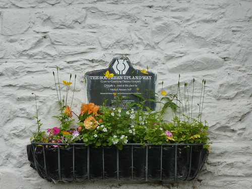
The Tibbie Sheils Inn, where the campsite is located on the little spit of land between St Mary’s Loch and Loch o’the Lowes, is where the trail was formally opened back in 1984, and a plaque in the wall of the pub commemorates the occasion. Sadly, the Inn has been closed for quite some time, and it doesn’t look likely that it will reopen any time soon. A pity, as it was a vital stop for backpackers on the way.
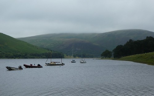
The trail for the most part, hugs the water of the loch on it’s south bank. There is a real mix of woodland and farmland along here, and it is nothing short of delightful with some great views over the Loch to the North.

There is a full 7 mile circuit of the loch too starting from Tibbie Shiels, and I thoroughly recommend it as a quite fabulous day walk. There is even an old AA members emergency telephone box to look out for as you walk round!
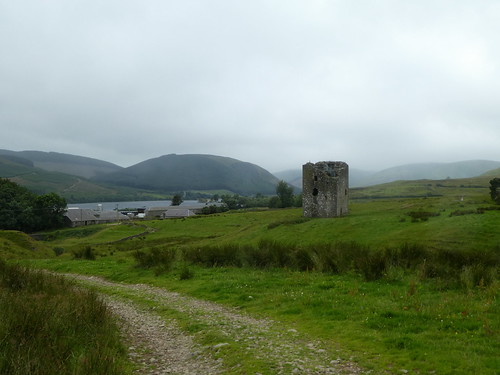
The last section along the Lochside was back to forest track, with restricted views and over stony ground, but it didn’t last long and the trail soon left it behind at a wier controlling water flow into the Yarrow Water. A signposted and information board pointed towards Dryhope Tower, an old Pele Tower typical of the region. I had been intending to visit it for some time now, and as I was finally walking past, I would have the chance to go and investigate.

The path from the loch was over farm land and fairly rough at times, tough going even though it was only around a mile or so to the tower. I reached there with Craig, who had camped at St Mary’s Loch as well. He pushed on, while I dropped my rucksack at a gate, preferring to leave it there than carry it the short distance there and back to the tower.
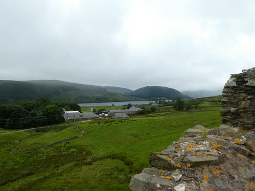
Most of the inside of the tower has gone, with only the roof and the outer walls remaining. A metal staircase has been installed so visitors can get up to the roof, and the vertigo inducing climb is well worth the effort with fantastic views over the loch. Leaving the tower I reluctantly picked up the rucksack once more and began my steady plod onward.
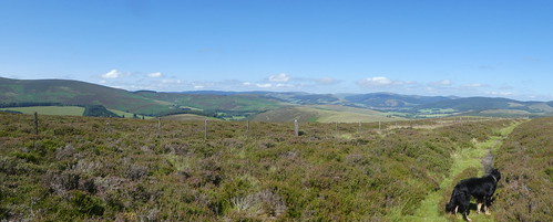
This was once again wide grassy track and nice easy walking, although the ground was pretty undulating at times. The landscape was awe inspiring, and it was sobering to think how remote the area actually was. It was a nice surprise to find my walking companions from the previous day resting by a footbridge with a fine outlook, and we continued on together towards Traquair.
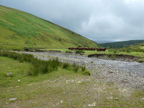
Since crossing into the Borders the character of the trail had changed beyond all recognition, and this section was no different as we crossed the open hill to the tiny settlement at Blackhouse. Here we were presented with a problem. A large group of cattle were happily planted right in the middle of the trail, blocking our way to a bridge across the Douglas Burn. Normally this wouldn’t present a problem, but as we had a dog with us it changed the situation entirely. While we kept out distance the cattle had spotted the dog, and were tracking it. There was no way I was attempting to walk through the herd. As we reached the river there was another bridge, free from the cattle. No problem, until we reached it. This had been the original crossing point, but was now abandoned and the rickety structure was adorned with signs saying “danger, unsafe structure, do not cross.”
It was a straight choice. The cattle or the bridge. The bridge won, hands down. Crossing one at a time, and very gingerly, we reached the road at the house and safety. Next was a seemingly never ending climb up through a conifer plantation. There was even a bench part way up, overlooking what once must have been a lovely view back over the valley below. The conifers here had grown up however, and the view was limited to the trees surrounding the bench.

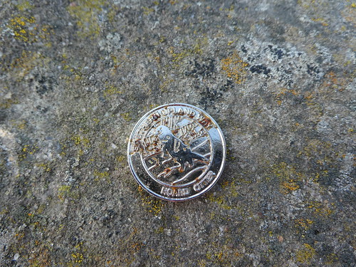
After what felt like an eternity, a gate appeared at the top of the hill, marking the edge of the plantation. Emerging onto the open hill was like leaving a tunnel and once again this was easy walking on a quite lovely path. As we marched forward there were tantalising glimpses of the hills around Traquair, hidden somewhat by the lump of Blake Muir ahead of us which we would soon be walking over. Here I spotted the next kist, finding my next piece of the hoard, and a bonus prize of a SUW pin badge mixed in with the coins.

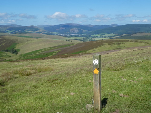
After this began a long steady descent to Traquair. The world opened out beyond and the sun was shining. This was trail walking at its best and while my two companions left me behind, I wasn’t too bothered as I was dallying taking photographs. The hill was gentle and the scenery magnificent, Innerleithen nestling in amongst the hills in the distance.

This was the sort of walking you wish carries on for ever, but all good things come to an end and eventually I reached the road that would take me to Traquair and eventually to Innerleithen. With the sun coming out in force it was warm, and I had very nearly run out of water. This is quite a long road walk, and although it is quiet, it is a narrow road, and can be a little awkward if you aren’t paying attention. At Traquair village I took a long rest on some benches close to the village hall. My accommodation was another mile or so down the road, and this was the point at which the SUW turned towards Melrose following the Minch Moor.

I said goodbye to my fellow walkers, who were planning on camping on the Minch Moor, and continued down the road to Innerleithen.
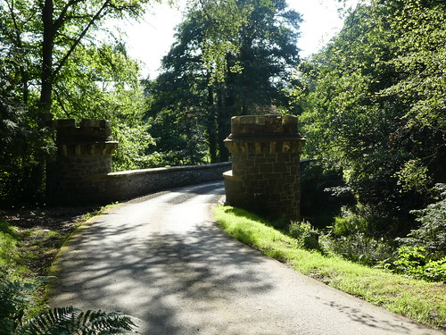
IMPORTANT: I didn’t realise at the time, but there is a path next to the road that runs virtually all the way into Innerleithen, rejoining the road where it crosses the Tweed. This road can be quite busy, and the path completely avoids the need to jostle with cars and bikes on the road!

I made my way to my accommodation, with one small problem. I had arrived a day early! My plan now was to have a rest day in Innerleithen and spend the day relaxing about the town, also getting one or two bits or bobs that I needed to replace, like the valve on my water bladder. Luckily the Traquair Arms Hotel was extremely accommodating and I was able to get the extra “pre-night” I needed. The hotel is excellent with a very friendly owner and staff and if you are doing this trail I’d highly recommend it!
A quite outstanding day of walking, with plenty of contrasts and historical interest too. If you do decide to have a rest day here, Traquair House is open to the public and has a tea room too, it is definitely worth a visit. One of the best days on the trail so far.

Leave a comment